Massachusetts State Parks
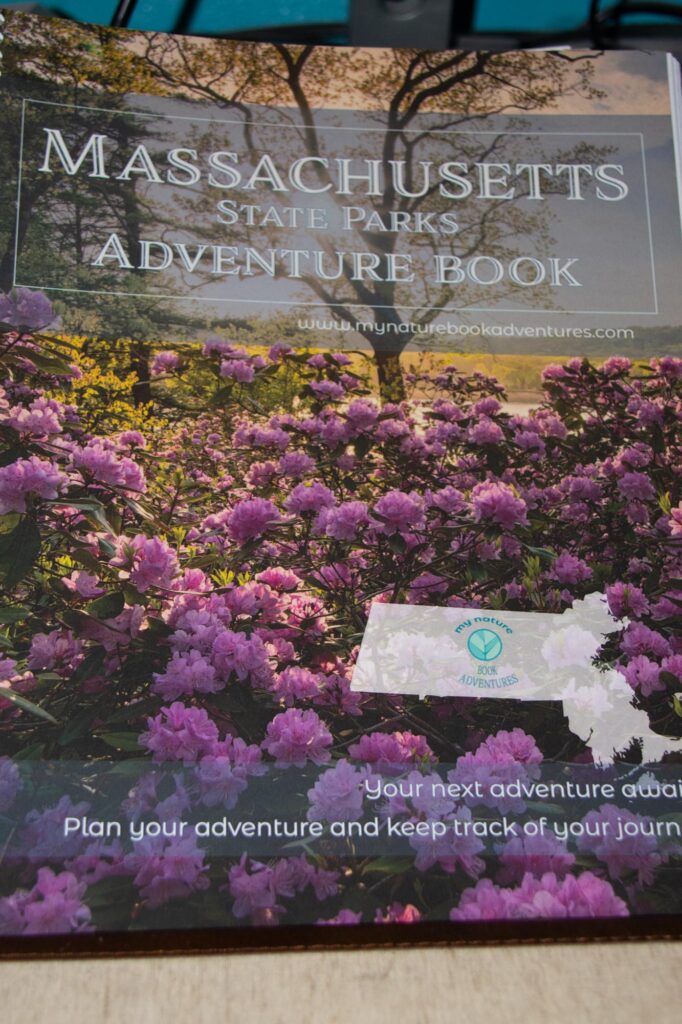
If you are a Facebook user you may have seen advertisements for Nature Adventure books. When they first came out with them I ordered a couple. I ordered National Parks, Massachusetts State Parks and New England Lighthouses. I figure that the Massachusetts State Parks and The New England Lighthouses would give me plenty to do and I’d have the National Parks for when I travel out of state. COVID and personal health reasons made a major dent in my travel the last 2 years but it’s time to think about getting out and about again.
Oh The Possibilities
I pulled out the Massachusetts State Park Adventure Book and there are 305 parks listed. They aren’t just state parks, there are Reservations, Historic Sites, beaches, State Forests, and Management Areas. So as a first step I decided to go through the list and see how many I’ve been to already. After all, this is the state where I’ve lived pretty much all of my adult life and I’ve always done a lot of exploring. I must have been to some of the places on the list!
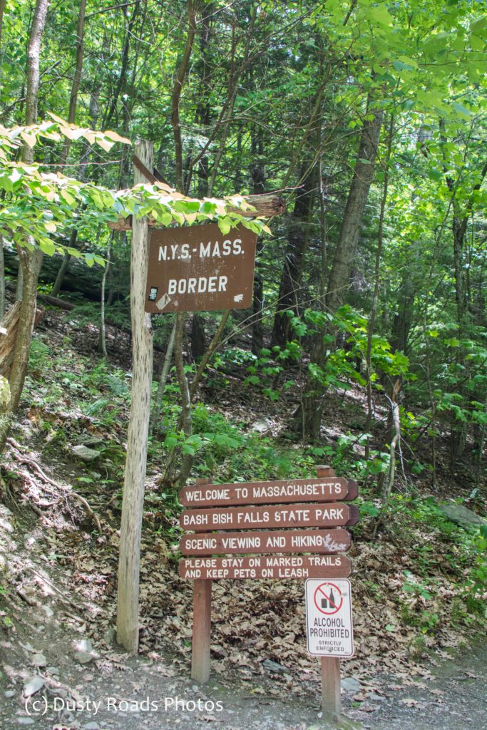
Bash Bish Falls State Park
The first one on the list that I spotted was Bash Bish Falls State Park. Of course I always mess it up and call it Bish Bash Falls. That just sounds better to me! I made the trek to Bash Bish Falls in June of 2017. Bash Bish Falls is located in the western part of Massachusetts on the New York state border. Located in the Town of Mount Washington it is also part of Mount Washington State Forest.
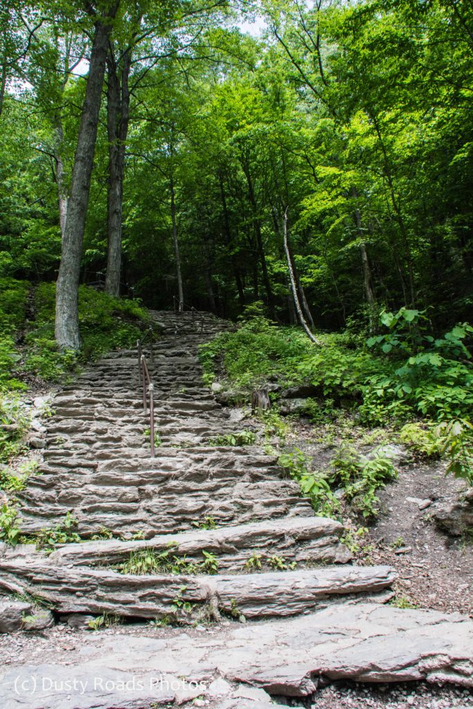
You can choose to make the hike easy or hard. The trail head in MA is steep and rugged. Probably not too bad going down, if you’re careful, but I sure didn’t want to have to make my way back up at the end of the day so I went into New York and used the New York trail head to get to the falls. It may be a little longer but it’s a gradual incline and it’s downhill going back.
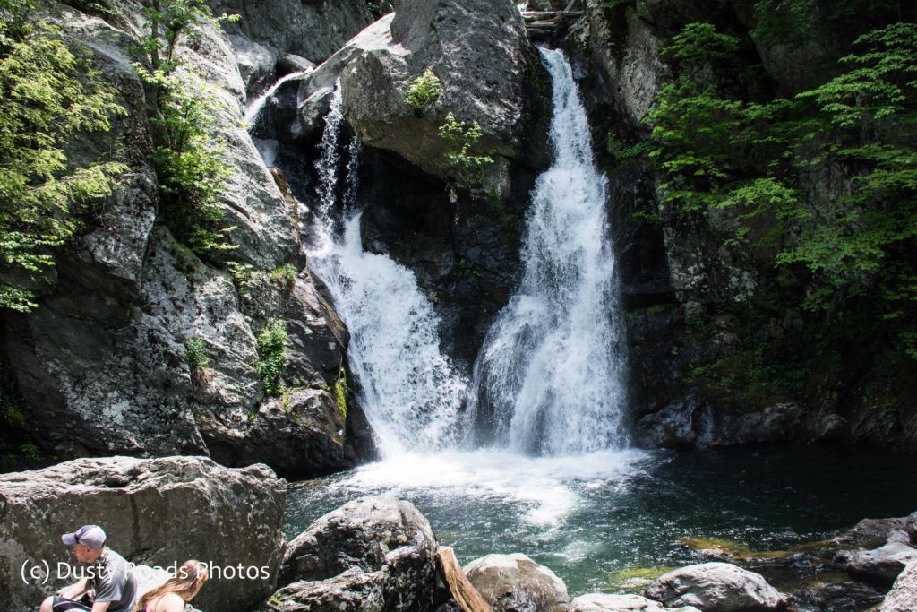
Bash Bish Falls is the highest waterfall in Massachusetts. The dramatic final pitch of Bash Bish Brook drops about 80 feet into an emerald plunge pool. It’s an enjoyable hike to experience the wonder and beauty of this deep, verdant gorge. https://youtube.com/shorts/-Vqd_OQmFsc?feature=share
If You Go
- From Massachusetts Parking Lot: Difficult ability, about 0.6 miles round-trip. Shorter, more rugged, and strenuous.
- From New York Parking Lot: Moderate ability, about 1.5 miles round-trip. Longer and gradual, but rocky and uneven.
- Nearby, Taconic State Park in New York state offers more visitor amenities, picnicking, swimming, and camping.
 The Wild Center, Tupper Lake NY


 The Spider’s Lair

 Port of Call, Ketchikan
 Then there was Juneau
 Skagway, Alaska


