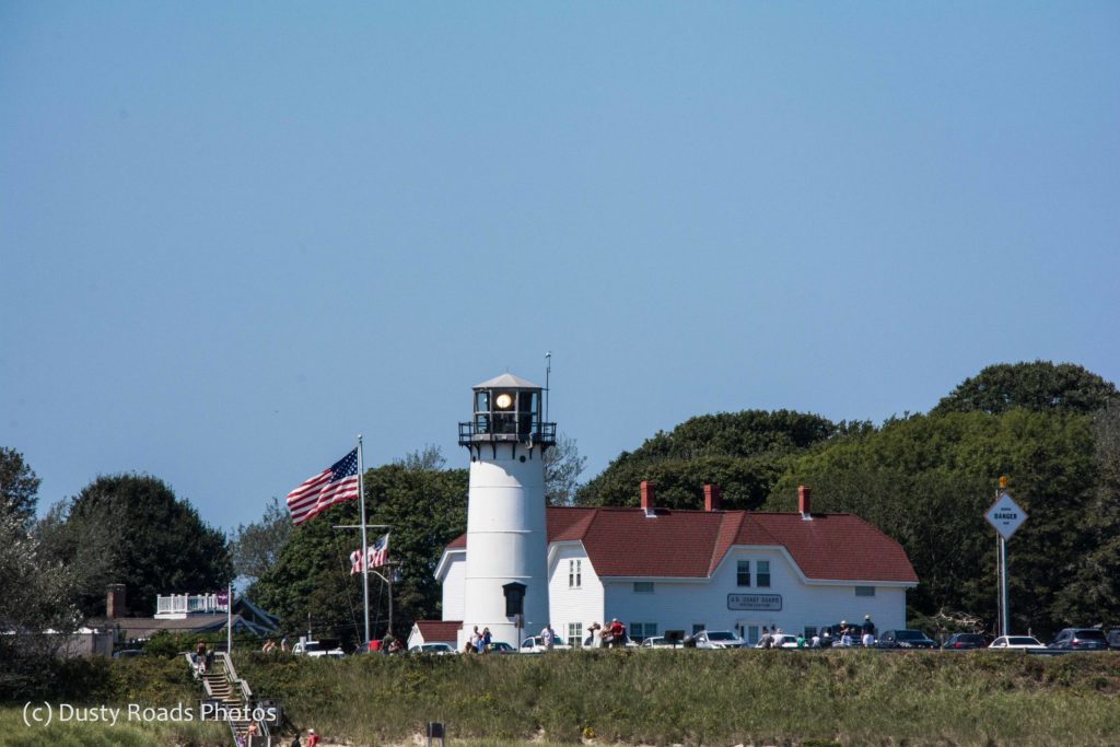
Cape Cod’s Mighty Sentinels
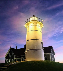
Nobska Light- Photo credit Linda Whitcomb
Some people are real lighthouse folks. They love them. Lighthouses have a mystique about them — they represent our relationship with the sea. They stand as guardians for sailors and provide a path of safety to snug harbors. They warn ships away from dangerous shoals.
If you’re one of those lighthouse people, this post is for you.
Cape Cod, with its hook into the Atlantic Ocean, presented a multitude of hazards. In response, we built lighthouses — lots of lighthouses — beacons to guide sailors home.
Today on Cape Cod you can visit eleven of these mighty sentinels. Not all allow interior tours, but all can be admired from the outside. I’ve started out many times to visit them all, but somehow I always run out of time or get sidetracked.
How many have you made it to?
Nobska Light (Falmouth/Woods Hole)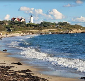
Nobska Light has watched over Vineyard Sound since 1829. Its original 30‑foot stone tower and whale‑oil lamp guided mariners through the tricky currents between Woods Hole and Falmouth. Over the years it evolved from a simple coastal beacon into one of Cape Cod’s most beloved landmarks. With its white tower, keeper’s house, and sweeping views toward Martha’s Vineyard, Nobska remains a place where history and beauty meet the sea.
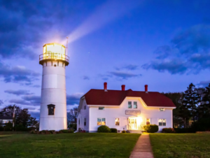 Chatham Light (Chatham)
Chatham Light stands watch over one of the most dramatic stretches of coastline on Cape Cod, where shifting sands and powerful Atlantic surf have challenged sailors for generations. First lit in 1808, the station has evolved through storms, erosion, and countless rescues, yet it remains a steadfast symbol of the Coast Guard’s presence on the Cape. With its crisp white tower overlooking the restless waters of Chatham Bar, this lighthouse feels alive — a place where history, danger, and beauty meet at the edge of the sea. Even from the outside, you sense the weight of its duty and the stories it has seen.
Stage Harbor Light (Chatham)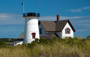
Stage Harbor Light sits quietly along the shoreline, a weathered sentinel overlooking the calm waters of Chatham’s southern coast. Built in 1880, it once guided fishing boats and coastal schooners through the harbor’s shifting channels, but today it stands retired, its lantern long dark. Yet the lighthouse still carries a certain grace — the kind that comes from decades of salt air, storms, and sun. Seen from the beach or by boat, Stage Harbor Light feels like a glimpse into an older Cape Cod, a place where time slows and the past lingers in the wind.
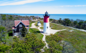 Nauset Light (Eastham)
Nauset Light is the lighthouse everyone recognizes — the bold red‑and‑white tower perched above the Atlantic, famous from the Cape Cod Potato Chips bag but even more striking in person. First built in 1877 and moved inland in 1996 to escape relentless erosion, it stands today as a symbol of the Cape’s constant dance with the sea. The surf below is never quiet, the wind never still, and Nauset feels like it’s holding its ground with quiet determination. Whether you catch it at sunrise or under a bright summer sky, this lighthouse carries the spirit of Eastham’s rugged coastline in every line of its silhouette.
Three Sisters Lighthouses (Eastham)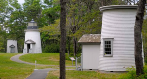
The Three Sisters are unlike any other lights on Cape Cod — three small, weathered wooden towers set inland among the pines, quietly telling the story of a coastline that has shifted and reshaped itself over centuries. Built in the 1830s to guide mariners past Eastham’s treacherous outer bars, the original trio once stood proudly along the shore, their three lights forming a distinctive pattern at sea. As erosion claimed the bluff, the Sisters were moved, retired, and eventually restored, now standing together like old friends who have seen much and endured more. Visiting them feels less like seeing a lighthouse and more like stepping into a chapter of Cape Cod’s past that refuses to be forgotten.
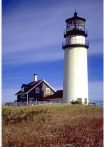 Highland Light (Truro)
Highland Light is the grand old sentinel of Cape Cod — the tallest, oldest, and perhaps most storied lighthouse on the peninsula. First lit in 1797 and rebuilt in 1857, it has watched centuries of ships pass along the treacherous “Backside” of the Cape, where deep ocean swells meet steep bluffs. In 1996, the entire tower was moved 450 feet inland to escape the relentless erosion that threatened to send it over the cliff, a dramatic reminder of how fragile this coastline can be. Standing beside Highland Light, you feel the sweep of history and the raw power of the Atlantic all at once. It’s a place where the past feels close, the horizon feels endless, and the lighthouse seems to hold its ground with quiet, unwavering dignity.
Race Point Light (Provincetown)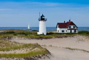
Race Point Light sits at the edge of Provincetown where the Cape feels wild and wide open, a place where sand, sea, and sky stretch out in every direction. First lit in 1816, it guided ships along the outer arm of the Cape, where strong currents and shifting sandbars made navigation treacherous. Reaching the lighthouse today often means a long walk through soft dunes, the wind in your face and the Atlantic roaring nearby — and that journey is part of its magic. When you finally arrive, Race Point Light feels both remote and welcoming, a sturdy white tower standing against the elements with quiet resilience. It’s one of those places where you can hear your own thoughts and feel the full sweep of Cape Cod’s untamed beauty.
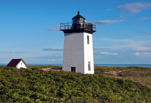 Wood End Light (Provincetown)
Wood End Light sits at the quiet edge of Provincetown, where the land thins into sand flats and tidal marshes before giving way to open water. Built in 1872, it guided ships past the tricky currents at the mouth of Cape Cod Bay, standing as a steady companion to Race Point and Long Point. To reach it, you cross the breakwater — a long granite path that disappears under high tide and feels almost otherworldly when the wind is calm and the harbor is still. When you arrive, Wood End Light feels peaceful and solitary, a simple white tower keeping watch over the shifting tides and the wide, empty horizon. It’s one of those places where the Cape feels both remote and deeply familiar.
Long Point Light (Provincetown)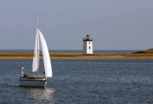
Long Point Light sits at the very tip of Cape Cod, where Provincetown’s sandy arm curls into the bay like a protective hook. Built in 1875, it guided ships past the harbor entrance and the shifting shoals that once made this stretch of water notoriously tricky. Reaching it today feels like traveling to the end of the world — a quiet walk across sand flats, gulls wheeling overhead, and the town shrinking behind you until all that’s left is sky, tide, and the steady white tower ahead. Long Point Light has a lonely beauty to it, a sense of isolation that’s peaceful rather than stark. It’s the kind of place where you can stand for a moment and feel the full sweep of the Cape’s geography, the curve of land meeting the open bay, and the lighthouse holding its solitary post with quiet grace.
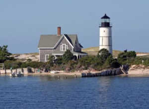 Sandy Neck Light (Barnstable)
Sandy Neck Light stands at the entrance to Barnstable Harbor, a quiet, dignified beacon tucked along one of the Cape’s longest and most beautiful barrier beaches. Built in 1857, it once guided schooners and fishing boats through the harbor’s narrow channel, but today it serves mostly as a picturesque landmark — privately owned, lovingly maintained, and best viewed from the water or the long, winding trail behind the dunes. There’s a peacefulness to Sandy Neck Light, a sense of calm that comes from its distance from the bustle of town. With the salt marsh stretching behind it and the harbor opening before it, the lighthouse feels like a gentle reminder of the Cape’s quieter side, where tides move slowly and the past lingers in the breeze.
Bass River Light (West Dennis)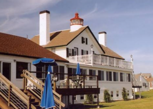
Bass River Light is one of Cape Cod’s quiet treasures — a small, graceful lighthouse tucked beside the Lighthouse Inn in West Dennis, still shining each night as a private beacon. Built in 1855, it once guided vessels along the busy Bass River channel, its light reflecting off calm waters and salt marshes that haven’t changed much in more than a century. Today it feels almost like a secret, a lighthouse you stumble upon rather than seek out, with the inn’s white buildings and the river’s gentle tide giving it a peaceful, timeless charm. Bass River Light may not be as famous as some of the Cape’s larger towers, but it carries a lovely intimacy — a reminder that even the quieter corners of Cape Cod have stories worth telling.
Closing Thoughts
Cape Cod’s lighthouses are more than landmarks — they’re storytellers. Each one has weathered storms, guided sailors, and stood watch over generations of coastal life. Whether you’ve visited one or all eleven, each lighthouse offers its own moment of connection with the sea and the history of the Cape.
Note: Most of the photos were taken from the internet. If I was able to give a photo credit I have done so. Many thanks to the talented photgraphers that captured these images.
Share this:
- Share on Tumblr (Opens in new window) Tumblr
- Print (Opens in new window) Print
- Share on X (Opens in new window) X
- Share on Facebook (Opens in new window) Facebook
- Share on Pinterest (Opens in new window) Pinterest
- Share on Reddit (Opens in new window) Reddit
- Share on LinkedIn (Opens in new window) LinkedIn


