Nantucket: Small Island, Long Story

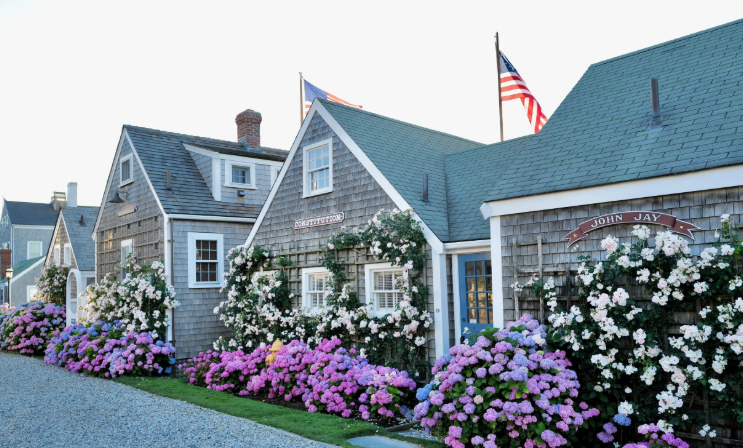
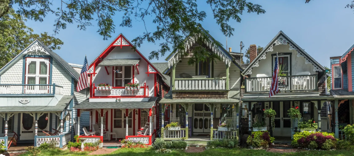
A row of weathered gray shingled cottages with green roofs, white trim, and climbing summer flowers in pink, purple, and white. Small signs reading “Constitution” and “John Jay” hang on the buildings, and American flags fly above them. The scene looks like a tidy, historic seaside village.

Nantucket: The Little Grey Lady of the Sea
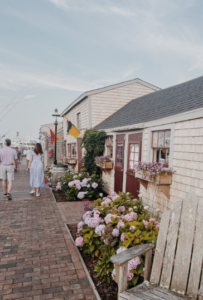
Before we leave the coast of Massachusetts behind, there’s one more island waiting out there in the Atlantic — small in size, enormous in history. Like Martha’s Vineyard, Nantucket has no bridge or roadway connecting it to the mainland. You reach it the old‑fashioned way: by sea or by air. Ferries glide across the Sound from Hyannis, Harwich Port, and New Bedford, and small planes touch down at the island’s airport, delivering summer travelers to a place that feels both remote and familiar.

And then, once you arrive, Nantucket reveals itself.

Nantucket is one of those places that feels familiar long before you ever set foot on it — a name that drifts through novels, travel magazines, and summer conversations like sea spray. Thirty miles south of Cape Cod, this tiny island has earned its nickname, The Little Grey Lady of the Sea, thanks to the weathered cedar shingles that cloak nearly every building. They fade to a soft, silvery grey, giving the whole island a muted, timeless palette.

I haven’t been to Nantucket yet, but researching it feels like paging through an old maritime diary. Cobblestone streets. Rose‑covered cottages. Lighthouses standing guard over dunes and surf. And beneath it all, four centuries of maritime history — whaling captains, Quaker merchants, shipwrecks, and the quiet heroism of life‑saving crews.

A Seaport Frozen in Time
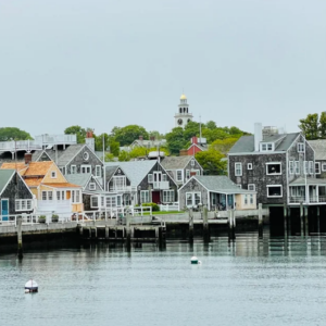
Nantucket is the southeasternmost town in Massachusetts, but it feels older than the state itself. More than 800 buildings predate 1850, and the National Park Service calls it the finest surviving example of an 18th‑ and early 19th‑century New England seaport town. Walk its streets and you’re essentially walking through a living museum — one that smells like ocean air and sunscreen.

The town center is a postcard: wharves lined with restaurants and boutiques, steepled churches rising above the rooftops, and those famous cobblestones that look charming until you try to roll a suitcase over them. In summer, the population swells to around 80,000, transforming the quiet off‑season island into a bustling colony of vacationers, seasonal residents, and day‑trippers stepping off the ferry with iced coffee in hand.

Before the Whalers: The Wampanoag Story

Long before the cedar shingles and whaling captains, Nantucket belonged to the Wampanoag people. They lived on the island for thousands of years, organized into groups led by sachems, with a population that may have reached three thousand. Their story is woven tightly into Nantucket’s early history — and into its whaling legacy.
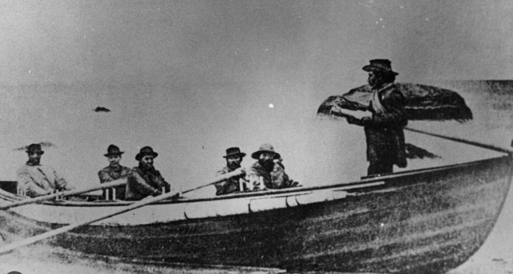
When English settlers arrived in 1659, they persuaded two sachems to relinquish their rights to the island for 66 pounds sterling. The Wampanoag later petitioned, arguing the sachems didn’t have the authority to sell the land, but the courts upheld the deeds. Sound familiar? Manhattan’s story echoes here — “sold” in 1626 for trinkets and trade goods, another moment where Native land shifted into colonial hands under deeply uneven circumstances. It’s a familiar American story — one of displacement, adaptation, and resilience.

The Wampanoag became carpenters, weavers, and eventually whalers. By the early 1700s, whaling boats launched from Nantucket’s shores were crewed mostly by Wampanoag men. A typical seven‑meter whaleboat had five Wampanoag oarsmen and one white man steering. Without them, Nantucket’s whaling industry — the one that would eventually dominate the world — simply wouldn’t have existed.
The Island That Ruled the Sea

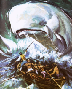
By the 18th and 19th centuries, Nantucket was the beating heart of the global whaling industry. Herman Melville captured the swagger of it in Moby‑Dick: “Two thirds of this terraqueous globe are the Nantucketer’s.”

The tragedy of the whaler Essex — rammed and sunk by a sperm whale — inspired Melville’s novel. Characters like Ahab and Starbuck were written as Nantucketers, shaped by the island’s culture of grit, danger, and ocean‑bound ambition.

Whaling wealth built the island’s grand homes, funded its churches, and shaped its identity. Even today, the Whaling Museum stands as one of Nantucket’s most important landmarks, telling the story of the industry that once made this tiny island the center of the maritime world.

Modern Nantucket: Salt Air and Summer Crowds
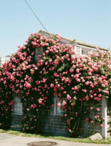
Today, Nantucket is a summer destination with a price tag to match — the average sale price for a single‑family home was $2.3 million back in 2018, and it hasn’t exactly gone down. But the island’s charm isn’t about exclusivity. It’s about atmosphere.

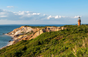
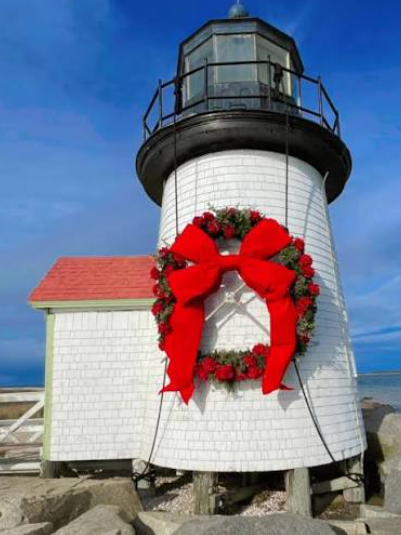
Fog rolls in like a soft blanket. Salt and sunscreen hang in the air on a July afternoon. Roses climb over cottage doorways in full bloom. It’s the lighthouses — Brant Point, Sankaty Head, Great Point — standing like old friends who’ve seen every storm.

Nantucket feels curated, but not artificial. Preserved, but not frozen. A place where history and summer coexist, each giving the other a little more meaning.

Leaving the Grey Lady Behind

And just like that, our time with the Little Grey Lady comes to an end. Nantucket may be small, but its story is anything but — a place shaped by wind, water, and centuries of human hands. As the ferry pulls away and the island softens into the horizon, you carry a little of its quiet dignity with you.

From Cape Cod’s sandy arm to Martha’s Vineyard’s rolling farmland to Nantucket’s weathered shingles, this stretch of Massachusetts coastline is a tapestry of islands, each with its own personality. Nantucket is the one that lingers — the one that feels like a whispered chapter in a much larger maritime tale.

Someday I’ll go. I’ll walk those cobblestones myself. I’ll see if the shingles really are as grey as everyone says. And I’ll bring back my own stories — the kind that only come from being there.
 

Martha’s Vineyard: Summer Colony, Sharks, and Storylines

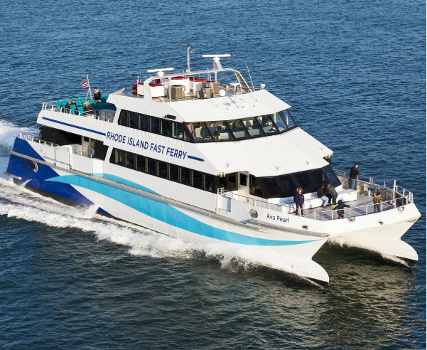
A high‑speed passenger ferry named “Ava Pearl” cuts across the water on a sunny day, carrying travelers on its open upper deck. The white and blue catamaran creates a wide wake behind it as it heads toward Martha’s Vineyard.

A Little Spin Around Martha’s Vineyard
We’re about to leave the Cape — at least for now — but before we go, there’s a little hook worth tugging on. Around here you’ll often hear people say “The Cape and the Islands.” Now, “the Islands” refer to Martha’s Vineyard and Nantucket, but here’s the fun twist: neither one is actually part of Cape Cod. They’re simply spoken together because that’s how locals frame the region.

So let’s start with the Vineyard — Martha’s, that is.

Getting There Is Half the Fun

When people say getting there is half the fun, they mean it literally. There’s no bridge, no road, no secret tunnel. Martha’s Vineyard is a true island. You either board a ferry or hop on a plane, and that’s the whole point — you choose to go, and the island rewards you for the effort.

The ferry ride takes about 45 minutes, and on a sunny day it’s as relaxing and pretty as coastal New England gets. Ferries run year‑round, but once May arrives your options multiply. Seasonal passenger service pops up from Falmouth, Hyannis, New Bedford, Quonset Point in Rhode Island, New York City, and northern New Jersey.

You can’t catch a ferry from Boston, but you can fly. Logan offers daily year‑round flights, and between May and October the schedule expands with routes from American Airlines (Washington, D.C.), Cape Air (multiple cities), Delta (LaGuardia), and JetBlue (Boston and JFK).

A Summer Colony With a Long Memory

The Vineyard’s reputation as a summer escape stretches back more than a century. Families return year after year, building traditions that last generations. Oak Bluffs became famous for its gingerbread cottages — tiny, colorful homes that look like someone dusted a Victorian village with powdered sugar.


Edgartown grew into the elegant counterpoint: white clapboard captain’s houses, quiet streets, and that postcard‑perfect New England calm.


Jaws Put the Island on the Big Screen

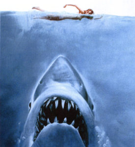
If the scenery feels familiar, it’s because Jaws was filmed here in 1974. Spielberg turned the Vineyard into “Amity Island,” and locals still point out filming spots. Say hi to Bruce while you’re at it. The movie changed the island’s identity forever — suddenly Martha’s Vineyard wasn’t just a summer colony; it was the shark island. (Fun fact: Amity means friendship. Just ask the mayor)

And Yes… the Sharks Are Real

Back when Jaws was filmed, great whites were rare in Vineyard waters. That’s changed. As the ocean warmed and the seal population exploded, the sharks followed the buffet. Today great whites are regular summer visitors around both the Vineyard and Nantucket. Researchers tag them, track them, and occasionally name them, and every summer brings a fresh round of “shark spotted off South Beach” headlines. Islanders take it in stride. Sharks are just part of the neighborhood now.

A Place Where Friendships Form Easily

Locals talk about “Vineyard friendships” — the kind that form over shared ferry benches, sunset drinks at Menemsha, or long walks on State Beach. Something about being on an island makes people open up. Maybe it’s the slower pace. Maybe it’s the salt air. Or maybe it’s the fact that once you’re there, you’re all in it together until the next boat leaves.

A Tragic Footnote: JFK Jr.

The Vineyard is also tied to one of the most heartbreaking moments of the 1990s. John F. Kennedy Jr.’s plane went down in the waters off the island in July 1999 as he was flying there for a family wedding. Islanders still remember that night — the search lights sweeping the water, the quiet that settled over the community.

The Island Today

Despite the fame, the sharks, the movies, and the history, Martha’s Vineyard still feels like a place where you can exhale. Beaches, bookstores, ice cream shops, bike paths, seafood shacks — it’s summer distilled. You arrive by boat, you leave by boat, and in between you get a little taste of island time.

Lighthouses, Eagles and a Seal , Oh My!

As we headed out of the harbor into the Bay of Fundy we passed the first lighthouse.

DSC_2944 copy

The 2nd one would be on Machias Seal Island.  Both Canada and the United States claim sovereignty. The Canadian Coast Guard continues to staff a lighthouse on the island.

Machias Seal Island

The whole Island is considered a bird sanctuary so boardwalks have been constructed for the humans to walk on to avoid stepping on nests or baby birds.

On the way out of the harbor we  spotted a pair of bald eagles.

DSC_2943 copy

It gives me a thrill to see so many of these magnificent birds. It was hard to get a picture  as the Barbara Frost was starting to pitch a bit as she picked up speed.

DSC_2942 copy

We didn’t see any whales.

It was about an hour trip and it felt like it. It was cold even when we huddled near the cabin. Hard to believe that it was 90 + in Boston!

Our first indication that we were nearing the island was a raft of small black and white birds.

A raft of Razorbills

They are called Razorbills and also nest on the island with the Puffins. Right after the razorbills came in sight a puffin flew across our stern. These bird make me think of bumblebees. They have such round little bodies and stubby wings. Its hard to believe they can fly at all!

Bumblebee of the Bird World

Right after that we spotted the lighthouse.

lighthouse copy

We were surprised to see some gannets mixed in with the razorbills on the rocks but the biggest surprise of our approach was the stranded seal!

Gannet & Seal copy

I mentioned the huge tides in a previous post. Well apparently this guy hauled out at high tide and forgot to leave when the tide receded.

Standed

Now we watched in fascination and horror as he slowly (and painfully) worked his way down the rocks. He landed face first more than once. I mean, that’s got to hurt!

Still Going

Determination

Almost there

He was almost to the bottom when we got the go ahead to land from the coast guard and had to miss his big splash. It was time for us to start part 2 of our big Puffin Adventure.


Block Island at Last

High Speed Ferry Returning to Point Judith

The ferry cast off and as soon as we cleared the jetties it was apparent that we were going to hit some heavy seas. I was on the top deck (a true glutton for punishment) which was open. The deck below was enclosed and warm but silly me wanted to stay topside. It was kind of like riding a bucking horse.

The bow would go up and up and then ever so slowly we’d begin to tip into the trough and then picking up speed the stern would rise and with a crash of spray the bow would slice the waves at the bottom of the trough.

Up and down! I watched the rollers moving toward us and tried to judge how much the boat would buck by the depth of the trough approaching.

 All though it was cold and wet the 55 minute trip passed quickly. Pretty soon we were passing another jetty into a calm harbor.

The waves were crashing over the sea wall making a spectacular scene.

The Ferry unloaded quickly and I found myself standing in the middle of the parking lot a bit lost. In my rush to catch the ferry this morning I had left my reservation confirmation in the car. It had the address for my guest house. I thought it was right near the ferry but I didn’t see it as I looked around but I did see a Chamber of Commerce building.

At the Chamber I asked for directions to Ashley House. At first the woman at the desk seemed puzzled but she quickly brightened up and told me to go through the Harborside Inn.  As I headed over there I was approached by a taxi/tour driver. He also said I’d find it in back of the Harborside Inn so I short-cutted down an alley and sure enough..there it was. Only one problem. There didn’t seem to be an entrance.  But there was an ice cream and pastry shop so I asked there how to get into the Ashley House. The girl took me out to the front and around the corner to an alley, pulled open a door and pointing said “Up the Stairs”. So up the stairs I went following a long corridor of polished wood floors and doors along the length but after I wandered the whole length and went back down the other stairs, I found myself back out side and still no place to check in.

I began to retrace my steps to the Chamber building for more detailed directions when I bumped into the Chamber lady leaving. She asked me if I’d found Ashley House. I told her yes I found the house but where do I check in?. She then went into more detail. The Harborside Inn owns Ashley House and if I go to the front desk of the Inn they will do the check in and give me my key. It seems so obvious in retrospect.

Check-in, once I found it, was quick and simple. The clerk even gave me a map and a list of restaurants that were open. Since this was still the “off-season” many of the restaurants and shops were still closed although you could see them being freshened up with new coats of paint and displays set up for the upcoming Memorial Day weekend.

The clerk pointed out the 2 Lighthouses. She said the southern lighthouse was an easy walk from town but the other lighthouse was more challenging.  I thanked her and headed to Ashley House to find my room. I was anxious to see what the inside of the rooms would be like after my trip down the corridor.

I wasn’t disappointed. It was a beautiful room with a large sleigh bed, a TV and a private bathroom with shower. That was important to me as a lot of the guest houses on the island have shared bathrooms. I was very pleased.

 It was beginning to lighten up and the rain had stopped so maybe I’ll be able to get a sunset picture after all! But first I need to stop in at the Ice Cream shop and buy something as a way of saying thanks. Without the clerk’s help I could still be wandering around looking for the entrance!