Driving the Mohawk Trail

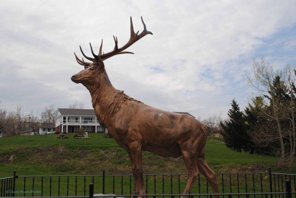
 Large bronze elk statue standing behind a black metal fence in Charlemont, Massachusetts, a well‑known roadside landmark along the Mohawk Trail with a house and trees in the background.

“The Elk of Charlemont — guardian of the Mohawk Trail.”

The Mohawk Trail Elk

If you’ve ever driven the Mohawk Trail, you’ve probably met this fellow — the famous elk statue standing watch in Charlemont. He’s been greeting travelers for generations, a quirky landmark from the old roadside‑attraction era. Locals simply call him The Elk, and for many of us, he’s the unofficial mascot of the Mohawk Trail. Seeing him always meant you were on one of New England’s most scenic drives, where the road bends, the hills rise, and the pace finally slows down.

A Fast Life on the Mass Pike

When I first moved to Massachusetts, most weekends were spent racing back and forth to New York where my family lived. I’d rush out of the house, toss an overnight bag in the car, and shoot straight onto the Mass Pike. Then I’d drive like a bat out of… well, let’s just say the posted speed limits and I weren’t always on speaking terms. It became a game — how much faster could I make the trip this week compared to last. I was lucky. Out of all those runs, I only got stopped once.

Breaker Breaker 19: The CB Era
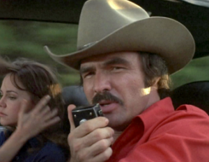
  
A person in a tan cowboy hat and red shirt sits in the front seat of a moving vehicle, speaking into a CB radio microphone. Behind them, another person with long brown hair looks out the window while brushing their hair back. The blurred scenery outside suggests the vehicle is in motion.

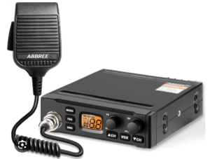
A close-up of a handheld CB radio microphone used for two-way communication.

Back in the ’70s, my need for speed had a little helper: the CB radio. Breaker Breaker 19 — any smokies ahead? Sometimes I’d slide into a “rocking chair” between two big rigs and we’d fly down the highway together. But one day, I decided to try something different.

Discovering the Mohawk Trail

Instead of putting the pedal to the metal, I went north on 128, cruised right past the Mass Pike entrance, picked up Route 2/2A near Concord, and headed west. Welcome to the Mohawk Trail.

You don’t take the Mohawk Trail for speed. You take it to enjoy an old‑fashioned, winding two‑lane road. It wanders through tiny villages and hamlets, follows rivers and streams, and even throws a full 180‑degree hairpin curve at you.
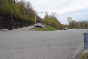
hairpin curve on the Mohawk Trail

That’s one turn you definitely don’t want to take at highway speed.
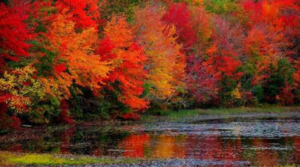
Briight fall colors and foliageFall Foliage at Its Finest

In the fall, the scenery is spectacular. Maple trees blaze bright red, and every other tree seems to toss in its own color for emphasis. The road winds through the Berkshires, always curving, always meandering — which makes perfect sense. For centuries, the Mohawk Trail served as a Native American footpath connecting tribes between the Hudson and Connecticut River valleys. Once automobiles arrived, it was only natural that a motor road would follow the same path.

One of America’s Oldest Scenic Byways

Today, the Mohawk Trail is one of the oldest scenic byways in the country, and it rewards anyone willing to slow down. Soak up the atmosphere. Explore the little towns and villages. This is some of the most beautiful country in all of New England. The Mohawk isn’t a route to rush through — it’s meant to be savored.

A Drive Worth Remembering

It’s still one of my favorite drives, even if I don’t get to enjoy it as often as I used to. Maybe that’s why it remains so special to me. So the next time you have a few extra hours and want an old‑fashioned road trip — a true Sunday‑afternoon drive — think of the Mohawk Trail and give it a try. You might be surprised by how much you love it.


Mt. McKinley Princess Wilderness Lodge

Time to change to The Mt. McKinley Princess Wilderness Lodge

We had one more day but it was at The Mt McKinley Princess Wilderness Lodge. Say bye-bye to The Denali Princess Lodge. Our luggage was picked up at 7 am but our bus didn’t leave until 11 am so we had time for a nice leisurely breakfast. The sun had finally come out and with the sun the mosquitos. You have to understand that Alaskans consider the mosquito the unofficial state bird. They are huge!

On the road againigloo

At 11 am our bus pulled out. Along the way we passed an abandoned “igloo” https://aroundustyroads.com/2013/07/02/one-more-lodge/

Moose scrambles up the bankShortly after that the bus to bus radio crackled to life. There was a grizzly chasing a moose along side the road. The lead bus gave us the mile marker but by the time we got there they were gone. No sign of either moose or bear. A bit farther along the way we spotted another moose. This one was also trotting along the side of the road. Just as my window came even it turned and scrambled up the bank toward the woods. 

The new lodge

antler door handlesThis lodge was pretty unique right down to the antler door handles. A shuttle bus took you around the property. The main activity here seemed to be Denali watching. It’s rare when the clouds clear to give a view of the peak. They even have an alert system so when Denali is visible you can check it out. We were lucky. A good portion of the mountain was visible the whole time we were there.

Denali

New Life Begins

Our Alaska visit was coming to an end but Alaska was coming to life as we prepared to leave. The baby animals we wanted to see were finally being born. A Mama moose has a pair of twins right near the lodge. Ms. Moose kept her babies well hidden until they could get strong enough to move. Clearly we had made our trip a week or two too early in the season. We will be leaving for Anchorage in the morning where we will catch our plane back to real life.

mama moose


Across the Canadian Border

The Rugged Canadian Wilderness

Once across the Canadian border we were able to see both the beauty and the wildness of the Canadian Rockies.  And it was cold here too. Lots of snow and ice.

Ice covered lake

At the Summit Rest Area we picked up our passports with our Yukon Stamps, grabbed a quick hot chocolate to ward off the cold then returned to the outside to explore the Yukon Suspension Bridge over the Tutshi River.

Crossing the Suspension Bridge

Yukon Suspension bridge

Tutshi RiverOK I’ll admit I am a bit of an adrenaline junky. More so when I was younger and I trusted my body a bit more but I still like things that make my heart pound a little. Crossing the Yukon Suspension Bridge did that. Stopping in the middle as it swayed and bounced so I could take pictures of the river was even more of a jolt. But it’s worth it. The Tutshi River was a raging maelstrom of white water. Its almost impossible to believe that the gold rush miners tried to raft down this river with their supplies.

Story Boards tell the Tale

Between the rest area and the suspension bridge were a series of story boards. They told  the miners’ tale of their hardships and extreme toil. Each miner was required to bring a year’s supply of food by the Canadian government to prevent starvation. In all, their equipment weighed close to a ton!

fog bound gulchThe Return

We loaded into buses for our return to Skagway. The fog continued to linger as the bus followed the same route as the train had in the morning. We were on our way to wrap up the trip with a “Garden Party” lunch. The lunch was forgettable as I can’t remember much about it now but I do remember the photographs of huge rhubarb leaves. The long hours of sunlight make up for the short growing season.


Garden Party

Back to the Ship

After the lunch it was back to the ship. As I recall we skipped any afternoon excursions to relax on our balcony.

One More Waterfall

Lower Falls Yellowstone River

I’ve got one more Waterfall on my list of stops for this day.  Lower Falls on the Yellowstone River is known as the Grand Canyon of the Yellowstone. I need to warn you, I didn’t fall in or get chased down to the bottom by a bear , or go over them in a barrel. I’ve noticed that I get far more “likes” when something scary happens to me. Unfortunately this will be disappointing for my thrill seeking readers. Its just an absolutely beautiful waterfall.

Lower Yellowstone Falls

Norris to Canyon Junction

I’m saving Norris Basin for my next Yellowstone trip so as my friends in the white Navigator turned left I continued on toward Canyon Village. There were a few more critter jams. The bison were taking their time crossing the road. At one critter jam the wait was over 20 minutes. I couldn’t see what was going on but once we started moving it was apparent. It was a huge herd of bison.  At Canyon Junction I made a right and soon spotted the parking area for the Lower Falls. A boardwalk leads out to a platform known as Lookout Point.

Lower Falls on the Yellowstone River

Red Rock Point

I really need to get over my back injury because on my next trip the trail to Red Rock Point is on my bucket list. The trail is only about a mile round trip but it’s steep! And I mean very steep! The bottom of this trail is consider the best place to experience the Lower falls and to get the best photos. Sadly,  I definitely wasn’t up to that hike this trip.

Red Rock Point

Inspiration Point and The Upper Falls

Another reason to return is that I didn’t see the upper falls at all. The road to Inspiration Point was closed and I wasn’t even aware that there was a side road called North Rim Drive. From what I’ve heard since my trip this allows for close views of the upper falls. Lower falls is the more spectacular if you base this assumption on size alone.  The Upper falls drops 109 ft. Pretty impressive by eastern standards but Lower falls drops 308 ft! Yes, I definitely want to explore this area more next trip.

Lower falls throws up spray

Return to Moose Falls

Moose Falls in Yellowstone

My first stop in Yellowstone was Moose Falls. Yes I’d been here yesterday but I wanted to find the trail to the bottom of the falls. I must have missed it yesterday and since today I was concentrating on waterfalls, it seemed appropriate to take another look. 

Crawford Creek Bridge

Over the Edge

After careful scrutiny I found what seemed to be a possible trail. As I tentatively started along it I saw that it soon started down along the rock face right next to the falls. The rocks made a series of rough steps. I moved carefully until I was almost at the bottom. I just couldn’t make myself take that last step. It was a bit bigger drop/step so I settled on the almost bottom.

Moose Falls

Sunlight, friend or foe

The early morning sun was slanting over the falls at a pretty steep angle. It wasn’t high enough to actually hit the falls yet but it was high enough to be heading right into my camera lens. Well, you can’t always get what you want so I decided to try to play with the light a bit and see what kind of results I could get.

Falling Waters at Moose Falls

A Pretty Falls

This is such a pretty falls when you get down near the bottom. There appears to be a cave behind the falls. I’m just guessing as I couldn’t get over there to verify it. Since the sun wasn’t filling the gorge yet I was able to get a slower shutter speed to make the water frothy and soft. A little different angle and the sun rays created a colorful series of bokeh spots.

Dawn at Moose Falls

If You Go

It was really nice sitting there next to the waterfall watching the sun peak over the edge. I could have stayed there for hours but there were other falls calling to me. If you go the Yellowstone, Moose Falls in located just inside the South entrance. The stream that creates  the falls is Crawfish Creek. There’s  parking in a pull off just over the bridge and it’s an easy walk to the falls.

Crawfish Creek over Moose Falls