Nantucket: The Little Grey Lady of the Sea
 Before we leave the coast of Massachusetts behind, there’s one more island waiting out there in the Atlantic — small in size, enormous in history. Like Martha’s Vineyard, Nantucket has no bridge or roadway connecting it to the mainland. You reach it the old‑fashioned way: by sea or by air. Ferries glide across the Sound from Hyannis, Harwich Port, and New Bedford, and small planes touch down at the island’s airport, delivering summer travelers to a place that feels both remote and familiar.
And then, once you arrive, Nantucket reveals itself.
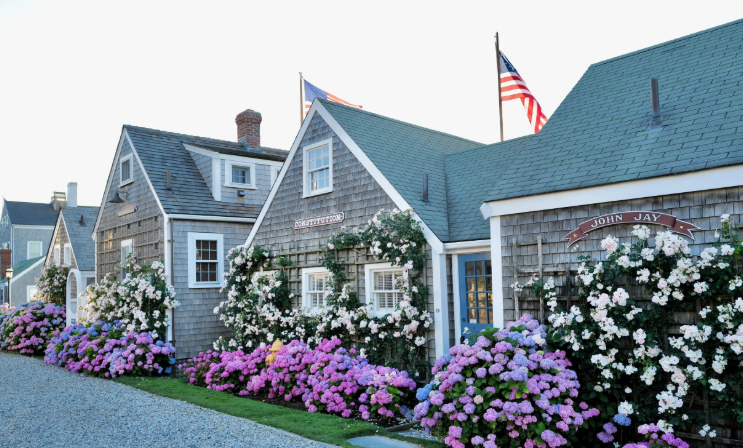
Nantucket is one of those places that feels familiar long before you ever set foot on it — a name that drifts through novels, travel magazines, and summer conversations like sea spray. Thirty miles south of Cape Cod, this tiny island has earned its nickname, The Little Grey Lady of the Sea, thanks to the weathered cedar shingles that cloak nearly every building. They fade to a soft, silvery grey, giving the whole island a muted, timeless palette.
I haven’t been to Nantucket yet, but researching it feels like paging through an old maritime diary. Cobblestone streets. Rose‑covered cottages. Lighthouses standing guard over dunes and surf. And beneath it all, four centuries of maritime history — whaling captains, Quaker merchants, shipwrecks, and the quiet heroism of life‑saving crews.
A Seaport Frozen in Time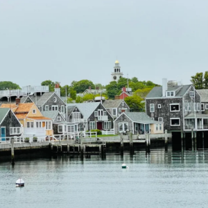
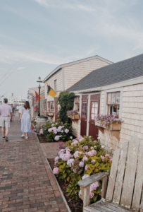
Nantucket is the southeasternmost town in Massachusetts, but it feels older than the state itself. More than 800 buildings predate 1850, and the National Park Service calls it the finest surviving example of an 18th‑ and early 19th‑century New England seaport town. Walk its streets and you’re essentially walking through a living museum — one that smells like ocean air and sunscreen.
The town center is a postcard: wharves lined with restaurants and boutiques, steepled churches rising above the rooftops, and those famous cobblestones that look charming until you try to roll a suitcase over them. In summer, the population swells to around 80,000, transforming the quiet off‑season island into a bustling colony of vacationers, seasonal residents, and day‑trippers stepping off the ferry with iced coffee in hand.
Before the Whalers: The Wampanoag Story
Long before the cedar shingles and whaling captains, Nantucket belonged to the Wampanoag people. They lived on the island for thousands of years, organized into groups led by sachems, with a population that may have reached three thousand. Their story is woven tightly into Nantucket’s early history — and into its whaling legacy.

When English settlers arrived in 1659, they persuaded two sachems to relinquish their rights to the island for 66 pounds sterling. The Wampanoag later petitioned, arguing the sachems didn’t have the authority to sell the land, but the courts upheld the deeds. Sound familiar? Manhattan’s story echoes here — “sold” in 1626 for trinkets and trade goods, another moment where Native land shifted into colonial hands under deeply uneven circumstances. It’s a familiar American story — one of displacement, adaptation, and resilience.
The Wampanoag became carpenters, weavers, and eventually whalers. By the early 1700s, whaling boats launched from Nantucket’s shores were crewed mostly by Wampanoag men. A typical seven‑meter whaleboat had five Wampanoag oarsmen and one white man steering. Without them, Nantucket’s whaling industry — the one that would eventually dominate the world — simply wouldn’t have existed.
 The Island That Ruled the Sea
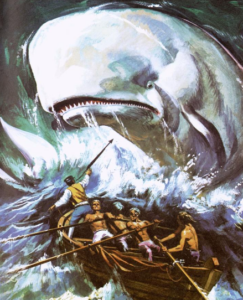
By the 18th and 19th centuries, Nantucket was the beating heart of the global whaling industry. Herman Melville captured the swagger of it in Moby‑Dick: “Two thirds of this terraqueous globe are the Nantucketer’s.”
The tragedy of the whaler Essex — rammed and sunk by a sperm whale — inspired Melville’s novel. Characters like Ahab and Starbuck were written as Nantucketers, shaped by the island’s culture of grit, danger, and ocean‑bound ambition.
Whaling wealth built the island’s grand homes, funded its churches, and shaped its identity. Even today, the Whaling Museum stands as one of Nantucket’s most important landmarks, telling the story of the industry that once made this tiny island the center of the maritime world.
Modern Nantucket: Salt Air and Summer Crowds
Today, Nantucket is a summer destination with a price tag to match — the average sale price for a single‑family home was $2.3 million back in 2018, and it hasn’t exactly gone down. But the island’s charm isn’t about exclusivity. It’s about atmosphere.
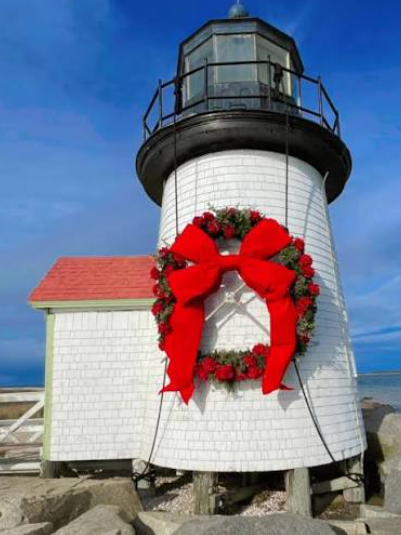
Fog rolls in like a soft blanket. Salt and sunscreen hang in the air on a July afternoon. Roses climb over cottage doorways in full bloom. It’s the lighthouses — Brant Point, Sankaty Head, Great Point — standing like old friends who’ve seen every storm.
Nantucket feels curated, but not artificial. Preserved, but not frozen. A place where history and summer coexist, each giving the other a little more meaning.
Leaving the Grey Lady Behind
And just like that, our time with the Little Grey Lady comes to an end. Nantucket may be small, but its story is anything but — a place shaped by wind, water, and centuries of human hands. As the ferry pulls away and the island softens into the horizon, you carry a little of its quiet dignity with you.
From Cape Cod’s sandy arm to Martha’s Vineyard’s rolling farmland to Nantucket’s weathered shingles, this stretch of Massachusetts coastline is a tapestry of islands, each with its own personality. Nantucket is the one that lingers — the one that feels like a whispered chapter in a much larger maritime tale.
Someday I’ll go. I’ll walk those cobblestones myself. I’ll see if the shingles really are as grey as everyone says. And I’ll bring back my own stories — the kind that only come from being there.

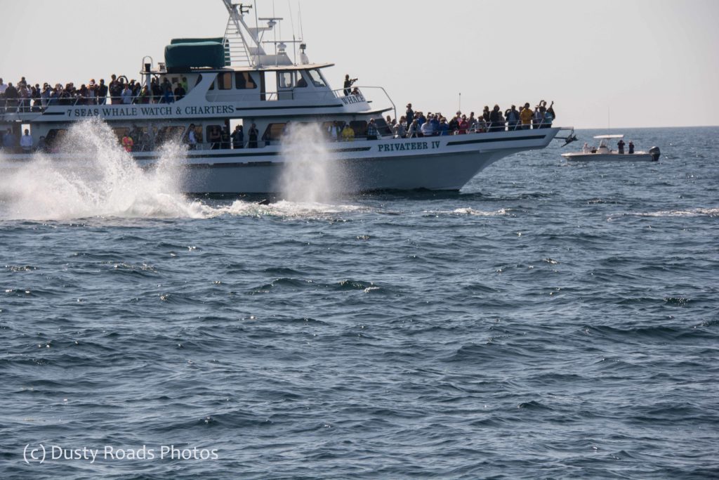


 while promoting conservation. A good trip offers education, excitement, and the unforgettable experience of seeing these magnificent animals in the wild. Humpbacks feed off Alaska all summer, gray whales cruise past California bluffs in winter, and the critically endangered North Atlantic right whale still passes close enough to Cape Cod to spot from a boat.
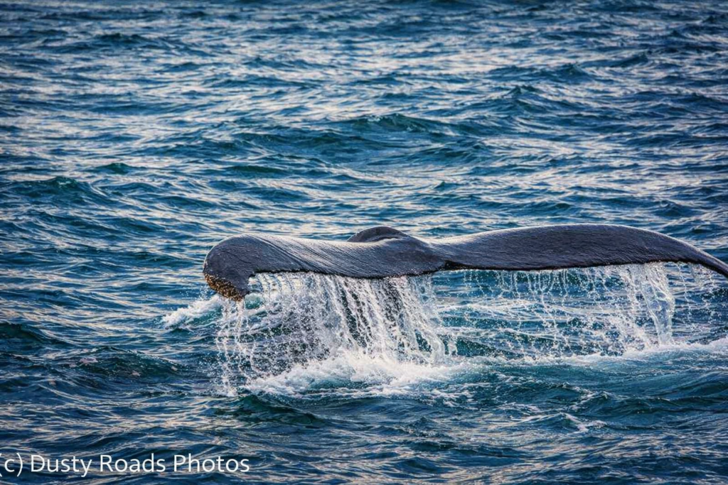

 Breaking News from the Feline Desk
 Mammoth Cave, Kentucky

 Space Launches in Florida